We’re just about there. The Kal-Haven trail is 33.5 miles, and yesterday we walked 23.3.
My plan had been “more than 20,” and we managed that, although we went a bit over.
It turns out to be surprisingly hard to plan a route with a very specific distance, if you want the route to be interesting. (It would be easy enough if you were willing to just map about a 2-mile loop and walk it 10 times.)
We did pretty well in the past using Google Maps to plan a route, entering waypoints and then going in and tweaking Google’s suggested route to match what we knew we were going to want to do. I did that again, but with a walk this long, I ran into some limits I don’t remember hitting before. In particular, there seems to be a 10-waypoint limit, and those “tweaks” to the route seem to use up waypoints. I don’t know if that wasn’t true with the old Google maps, or if our earlier walks just didn’t need more waypoints than that.
Without being able to tweak the route to match what we were going to do, I just entered points of interest for each of the corners of our walk, then fiddled with them a bit until I saw that we were at 20.1 miles. Then I figured we could just adjust it on the fly. It almost worked.
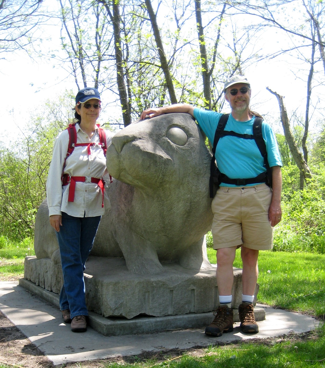
The route was pretty similar to our longest walk of last year, except that we’ve decided to carry our lunch on the trail, so we skipped the leg to Milo’s Restaurant. We walked to the Olympic Monument near Parkland College, then to Busey Woods (via downtown Champaign and Crystal Lake Park), then to Meadowbrook Park, where we had our lunch at the Prairie Viewing Platform. (We paused shortly after to get the above picture of us posing with the giant rabbit sculpture.)
The other place I particular thought we ought to stop was Triptych Brewery, which we’d never made it to before, even though they’ve been there for a year. (We go almost right past it several times a week—in particular, when she walks home from taiji class, Jackie passes just three or four blocks away—but always in the morning when it seems a little early for beer, and anyway they’re not open.)
It wouldn’t be a long walk from Meadowbrook to Triptych, if you wanted to walk along Windsor Road, but that sounded unpleasant. Instead we hiked north up Race and then cut across through married student housing and the arboretum, took Hawthorn through the research park, crossed the railroad tracks at St. Mary’s, and then headed back south on the Boulware Trail. That probably added a good mile to our route.
We made it to Triptych around 4:00 PM. The joint was hopping, which was good to see. They had about 10 beers on tap. Jackie had a honey basil blonde ale, which she liked very well. (The honey and basil were very subtle, she said.) I had their dry Irish stout, which was also excellent.
As we were passing through the research park, we’d calculated the distance we were going to end up walking (because of her walks from taiji, Jackie knew just how far it would be from Triptych to home), and we knew we were going to come out over our planned 20 miles. But we really wanted those beers, so we decided to just take the most direct routes and hope for the best. And it worked out fine.
The first 5 miles over our previous very long walk was no problem. After that, things got kinda tough—we were tired and footsore—but there was never a point where we worried that we might not make it. If you’re interested, Endomondo has the GPS track and details. (Ignore the altitude data. When the phone loses the GPS signal, it often inserts a point with an altitude of zero. However, no point in Champaign County is at sea level.)
In my report last week on our previous very long walk, I mentioned that my plan for after the 20-mile hike would be a 25-mile hike. Almost as soon as I’d posted that, I realized that obviously our next hike should be 26.2 miles. Duh.
The Illinois Marathon passes just a few blocks from our apartment. The closest point is very near the midpoint of the race.
I grabbed the map off their website, and figured we could just walk to the nearest point, pick up the route there, walk it until the finish line, cross over to the starting line (just a block or two from the start) and then carry on until we get back to the midpoint, and then go home.
It’s not a plan yet. More of an intention. Maybe just a notion.
Today we’re going to rest, have a mother’s day lunch with Jackie’s mom, and take her out for something fun. Maybe a walk in the woods, or maybe (if the predicted rain arrives) to the art museum.
Yay, awesome! Go you! And walks are much more fun with beer involved.
That’s right! I don’t know if we’ll get beer on our Kal-Haven walk until the end—but we’ll definitely get it then!